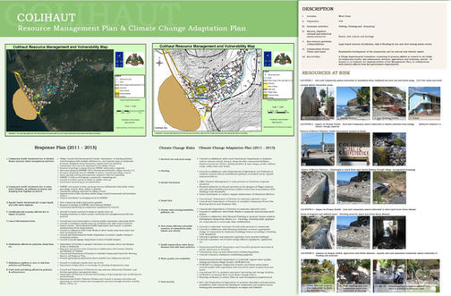
COMMUNITY RESOURCE MAPPING AND CLIMATE CHANGE VULNERABILITY ATLASES - DOMINICA
Global Environment Facility (GEF)/ World Bank/ United Nations Environment Programme (UNEP)/ Government of the Commonwealth of Dominica.
January 2009 to August 2011
In collaboration with various institutions and with the GEF/World Bank Special Program on Adaptation to Climate Change (SPACC) Project, the Team Leader from de Romilly & de Romilly Limited developed a Handbook for Community Resource Mapping and Climate Change Vulnerability Atlases and led a training program on Community Climate Change Vulnerability Mapping.
A training-of-trainers program was utilized, with the Handbook tested in the field and used to train over 120 people including extension officers from Departments of Agriculture, Forestry, Fisheries, Environment, Physical Planning as well as members of the Village Councils (Local Government) to coordinate the development of Community Maps, Vulnerability Atlases, and Community Resource Management and Climate Change Adaptation Plans in 10 vulnerable communities in Dominica.
The process was highly participatory, with extension officers, local residents and Village Councils effectively collaborating. Plans incorporate both terrestrial and marine/aquatic components. The partnership with the SPACC project resulted in a very good example of collaboration and synergistic work among GEF projects. Laminated 48 inch x 36 inch copies of these vulnerability maps and adaptation plans were produced and printed for distribution to the participating communities.
The Community Resource Management Plans/Maps/Atlases are being used by the Department of Physical Planning to inform the National Physical Planning Process in order to prepare the National Physical Development Plan and a National Land Use Policy. This was a very innovative process in the country where a land information database was not available before this project and decisions concerning the management of risks from climate change were taken based on very few available data.
The Community Resource Management Plans/Maps/Atlases activities are currently being supported by both the European Union, GEF, the World Bank and the Caribbean Development Bank (CDB) under their follow-on programmes in Dominica.
Additionally, the Government of Dominica intends to expand the process of preparation of Community Resource Maps, Vulnerability Atlases and Community Resource Management Plans to all communities in Dominica under Component 2 of the US$16 million Strategic Program for Climate Resilience (SPCR) funded under the Pilot Program for Climate Resilience (PPCR) which is part of the Strategic Climate Fund (SCF), a multi-donor Trust Fund within the Climate Investment Funds (CIF).
The process of community engagement in preparing SLM Maps/Atlases/Plans is being promoted as a model for other Caribbean countries by the Caribbean Community Climate Change Centre (CCCCC).


